FP
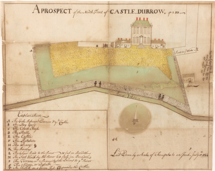
Survey map of part of the Castle Durrow estate, Co. Laois
8 January 1744
2022/92
This survey map, initialled FP, shows the north front of Castle Durrow, the terrace to the north of the house, the ‘Descent’ to the ‘River Urkin’ (Erkina), and an ‘Obelisk on a Green Hill Opposite the Castle’. Castle Durrow itself appears as a two-storey, five bay house with three attic dormer-windows and a high-pitched roof with four tall chimneys. Attached to the main block are single-storey wings containing stables and coach house (left) and kitchen and dairy (right).
Benjamin Crawley superintended the building of Castle Durrow for William Flower between 1715 and 1726. This is the house depicted on the map. It was expanded to a nine-bay block in the mid-eighteenth century, but retained its distinctive dormer windows until the second half of the twentieth century.
The Buildings of Ireland records that in 1743 ‘marble ornaments were provided by one Barnaby Domano to adorn an obelisk’. This may be the obelisk shown on the drawing, though whether this is the same structure as remains on the site is open to question.